
The European Space Agency has published images taken by the Mars Express spacecraft. They show traces of the Martian ice age.

Over the past 2.5 billion years, our planet has experienced several ice ages. These were part of an ancient geological cycle caused mainly by changes in the Earth’s orbit around the Sun and fluctuations in its axis of rotation. The last glaciation peaked about 20,000 years ago, lowering the planet’s average temperature to 7–10 °C (8 °C lower than today).
But Earth is not the only planet to have experienced glaciation. Ice ages also occurred on Mars, as clearly demonstrated by images taken by the Mars Express spacecraft. They show an area known as Coloe Fossae.

Coloe Fossae is crisscrossed by long parallel lines resembling scratches. These are the remains of glaciers that repeatedly advanced and retreated, gradually carving out deep depressions and trenches. Like other parts of Mars, this region is covered with numerous craters of varying degrees of erosion. At their bottom, you can see another sign of the glacial period: spiral patterns.
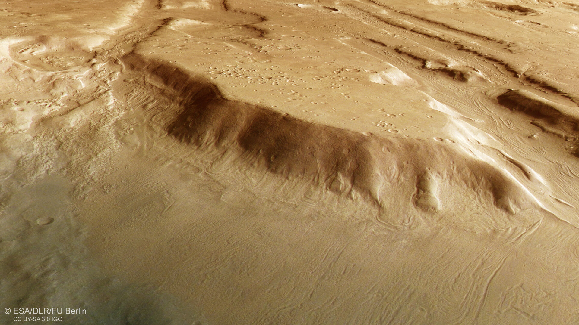
These patterns provide insight into the climate of the Red Planet in the past. They were formed when ice flows covered with a thick layer of rock material slowly flowed across the surface of Mars (something similar happened on Earth).
The area photographed by Mars Express is located at 39° north latitude, which is very far from the north pole and raises the obvious question of how ice could have reached such low latitudes. The answer lies in the pulsation of advancing and retreating glaciers. Although Mars is currently dry, throughout its history it has experienced alternating periods of warming and cooling, freezing and thawing, caused by changes in the tilt of its axis.

During cold periods, ice spread from the poles of Mars to the mid-latitudes, and when it got warmer, it receded, leaving behind characteristic traces. Spacecraft have discovered valleys and craters filled with glacial deposits across this entire latitudinal band, evidence of global climate change on the planet. This area may have been covered in ice as recently as half a million years ago, when the last ice age ended on Mars.
Earlier, we reported on how Mars Express photographed a potential landing site for a manned expedition.
According to ESA
