

The NISAR radar showed what an Antarctic nunatak looks like beneath the thickness of the ice. New orbital imaging has turned the harsh landscape of East Antarctica into something like an artistic canvas, where streams of frozen water glow in purple and green. Scientists have given the image the unofficial name “hummingbird.”
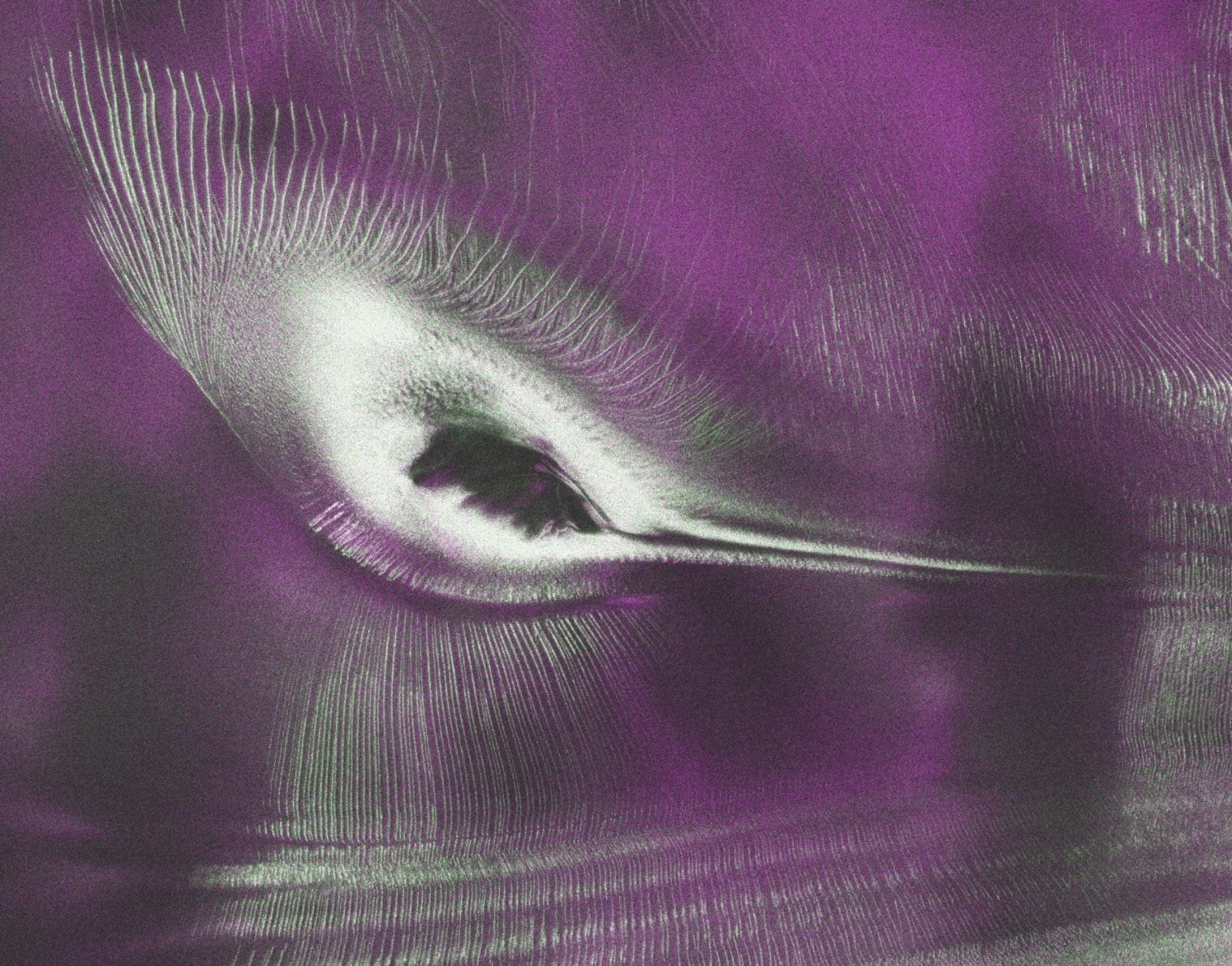
A Rock Amid an Ice Stream
The nunatak, officially known as Nunatak Zaterjavshijsja, is a mountain peak in the Prince Charles Mountains that protrudes from the ice sheet about 40 kilometers southwest of Mount Newton. Its name means “the nunatak that got lost.” The ice around the rock moves northeast toward the ocean, while the peak itself acts as an obstacle that creates stress within the ice mass.
It is precisely because of this pressure that deep cracks form, visible in the image as sharp green lines. They radiate from the nunatak for tens of kilometers, like rays. Without the radar vision of the NISAR satellite, this structure would have remained invisible beneath the layer of snow.
How Radar Colors the Ice
The colors in the image are not added for beauty. They reflect how L-band microwave signals of different polarizations interact with the ice surface. The NISAR satellite’s radar transmits and receives signals with horizontal and vertical polarizations, which allows it to determine the surface structure and the nature of the radiation scattering.
Areas of dominant polarization-preserving reflection typically correspond to relatively flat ice surfaces and are shown in purple in this image. The green areas indicate strong cross-polarized scattering, which occurs where radar waves are repeatedly reflected from cracks, irregularities, or other complex ice structures. Therefore, the network of deep glacial cracks is highlighted in green.
The white color in the image indicates zones where both types of reflection are equally strong. This may point to mixed surface and volume scattering within the same area. Such a combination is rare and indicates a complex glacier structure that cannot be seen with optical instruments.
The First Radar with Two Frequencies
The NISAR satellite is a joint project of NASA and the Indian Space Research Organisation, ISRO. It was launched on July 30, 2025. It is the first spacecraft in history to carry two synthetic aperture radars operating at different wavelengths.
The L-band system, with a 24-centimeter wavelength, was developed by NASA’s Jet Propulsion Laboratory at Caltech, while the Indian side provided the S-band system with a wavelength of 9.4 centimeters. Both instruments operate using a 12-meter deployable mesh reflector supplied by NASA for the mission. It is the largest radar antenna the agency has ever sent into space.
The image of Nunatak Zaterjavshijsja was created in August 2025, at the beginning of the mission’s scientific phase. NISAR data are already openly available through the Alaska Satellite Facility, NASA reports.
Researchers hope that such images will help them model the movement of Antarctic glaciers more accurately. The cracks seen by the radar are not just a beautiful picture, but signs of mechanical stress that may accelerate the sliding of ice into the ocean.